

Eighty-eight years ago, Warren Manning, an important landscape architect of the era and disciple of Frederick Law Olmsted, developed a plan for the City of Athens. Manning’s plan encompassed an area similar enough in scope to our contemporary city center that it can speak to many of our present areas of controversy, including Prince Avenue, downtown and Oconee Street.
I recently ventured into the new UGA Special Collections Library to take a look at blueprints that resulted from that planning exercise, journeying up the stairs through the building’s (first) lobby, around the spiral staircase of the rotunda on the second level, and through two sets of locked and attended doors into the Hargrett Library Reading Room. The formal and impressive sequence of civic spaces leading up to and through the library draws upon ideas of Manning’s era, especially those associated with the City Beautiful movement. But, it may have been other ideas of the time, such as the Garden City movement, that more influenced Manning in his recommendations for Athens.
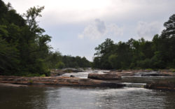
The Manning drawings are fascinating, not just for what they recommend, but for how they capture the whole scope of the Athens community at the time. Then, there were two streetcar lines in Athens, one looping down Milledge (via Hill Street) and back up Lumpkin (how they conquered the hill I don’t know), along with the more familiar loop along Boulevard and Prince. The map outlines the four hydroelectric stations that supported that system. Station No. 1 was at Mitchell Bridge (just upstream from Lester’s Branch, now often called Hunnicutt Creek), and No. 2, the Tallassee Shoals Hydro Station—now demolished and rebuilt as a modern power plant—was a few miles upstream. No. 3 was on a much smaller water body, the intown stream sometimes known as Brickyard Creek across the railroad tracks from the Southern Mill, in Boulevard. The car barn for the trolleys was nearby, along with other Georgia Power offices and substations. No. 4, the Barnett Shoals Hydro Station, was the farthest afield, in Oconee County.
An early transmission network is sketched out, a pioneering mark of the infrastructure that was to come. It’s interesting to consider that at the time, the vast majority of the county would have been fields, and so if those same transmission routes are in use today, then the forests have actually grown up around them, though it appears they were sliced through.
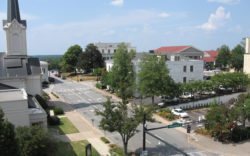
Numerous “landing fields†dotted the farmland surrounding the county, of which only one remains today, as Ben Epps Airport. At the time, the street grid downtown was much more extensive, predating both historical and present-day urban renewal. Of course, the area was much more residential at the time; the majority of the commercial core stood between Washington and Broad streets, with smaller, dispersed footprints illustrated on the more northerly blocks.
Some of the early considerations about sewage and water are also apparent from the plan, with recommendations for water quality areas to be set aside on the Middle and North Oconee rivers, downstream from town. “For Oconee Valley Watershed, purification fields of 20 acres should be acquired at a point†below where East Campus now rises, the map dictates. Another 10-acre field is proposed on Bobbin Mill Creek, which feeds into the Middle Oconee.
“In Sandy Creek Valley, Athens’ present water supply, and in Trail Creek Valley, the future water supply, public forests should be established, especially on steep slopes and wet lands not fit for tillage, by city, county or state, and other protective measures taken to assure pure water.†This prescient recommendation predates the establishment of Sandy Creek Nature Center and Park, as well as Cook’s Trail, by decades. It’s also interesting that another such public forest network was proposed for Trail Creek, which was designated as the future water supply for Athens.
Early versions of a greenway network were also proposed, with “The Bluff Park†on the western bank of the North Oconee, near where Aguar Plaza is currently built. Tanyard Creek and Trail Creek also have park-like trail corridors sketched out, the south fork of Tanyard being designated “The Proposed Botanic Park.†Also included are plenty of suggestions for new pathways that increase the connectivity of the city, snaking through larger blocks of Boulevard and elsewhere. A park is proposed for the Easley Mill property, where the granite outcrop will soon be blasted away for student housing.
An early version of what we now know as the bypass is also shown, with dashed lines denoting proposed “trafficways†looping around the north and east side of the city in a shape very close to the current configuration, before heading south and west and ultimately paralleling the Middle Oconee roughly to the historical Epps Bridge. Of course, the parkways of that era were quite a bit different from the limited access highways of today. Numerous other new trafficways were also proposed, tying various neighborhoods together, often in the same curvaceous character.
As we discuss the planning of Athens’ future, it’s important to realize that this has been done before, not only here, 88 years ago, but in just about every other community in the country. Further, while some of the ideas that were proposed in Manning’s plan were very specific responses to the conditions at that point in time, many of them are the sorts of self-evident general principles of good planning that people have come back to again and again. Among these, connectivity and a healthy balance of accessible greenspace throughout the city are especially worthy of reaffirmation.
The questions that the Manning Plan has most effectively raised in my mind have to do with the scale and scope of the planning effort currently under consideration: a downtown master plan. At the time (well before city-county unification), the study took in the whole of the City of Athens, and that might be a better and more synoptic planning unit, as opposed to a single district or corridor. Further, there’s a lack of compartmentalization of the varying urban infrastructures in this historical plan, which we would do well to revisit. There are conflicts between the strategies of public utilities, parks, planning, and schools to provide service, and that lack of governmental cohesion has produced many of the conflicts in this community. If we’re going to move forward, perhaps the best place to start is by looking back.
Like what you just read? Support Flagpole by making a donation today. Every dollar you give helps fund our ongoing mission to provide Athens with quality, independent journalism.