
For the many Flagpole readers who are also amateur urban planners, there’s nothing like tilting back a cold one at Friday happy hour and talking zoning—and we don’t mean whether the Dawgs should run a 1-3-1 trap.
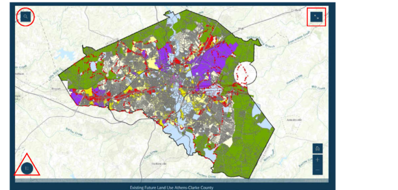
The new Future Land Use Map is Athens’ first update in 25 years, and it’s intended to guide growth for the next two decades. With Athens expected to add 30,000 people by 2050, where will they all live? Based on community input, the Future Land Use Map pinpoints areas that can handle the growth—primarily downtown, around the mall and at major intersection “nodes” across the county.
The ACC Planning Department has scheduled 10 drop-in sessions to view the Future Land Use Map. All of them take place from 5:30–7 p.m. except the second, which is from 10 a.m. to noon.
• Friday, Apr. 4 at Athentic Brewing Co. (108 Park Ave.)
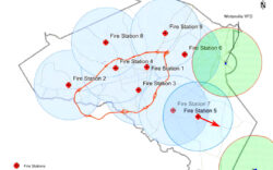
• Saturday, Apr. 5 at Fire Station #3 (1198 Milledge Ave.)
• Monday, Apr. 7 at New Faith Tabernacle Church (198 Peter St.)
• Thursday, Apr. 10 at the Lyndon House Arts Center (211 Hoyt St.)
• Monday, Apr. 14 at East Athens Baptist Church (4325 Lexington Road)
• Wednesday, Apr. 16 at Hilsman Middle School (870 Gaines School Road)
• Thursday, Apr. 17 at the Athens-Clarke County Extension office (275 Cleveland Road)
• Monday, Apr. 21 at Chaplewood Methodist Church (100 Janice Drive)
• Wednesday, Apr. 23 at Fowler Drive Elementary School (400 Fowler Drive)
• Wednesday, Apr. 30 at the Athens-Clarke County Library (2025 Baxter St.)
Residents can also view documents and leave comments online at accgov.com/compplan.
Like what you just read? Support Flagpole by making a donation today. Every dollar you give helps fund our ongoing mission to provide Athens with quality, independent journalism.